
http://antarvasnavideos.pro sex videos kinky babe fisting her large pussy. https://bigboobslovers.net/ hungry mom loves throat fucking.

Workshop Progress on the use UAS Techniques for Environmental Monitoring: program and presentations
7 March 2019
Estimating root zone soil moisture across the Eastern United States with passive microwave satellite data and a simple hydrologic model
6 September 2019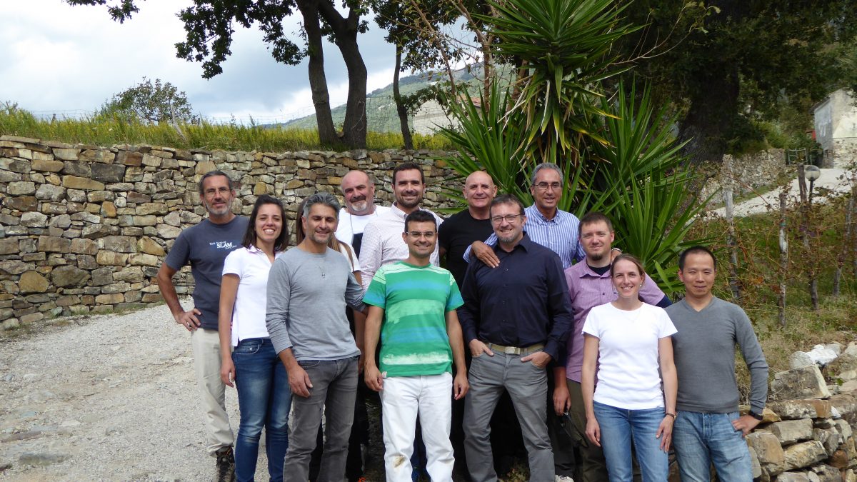
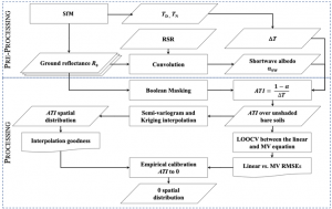
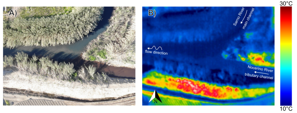
Several methods have been developed to map soil water content exploiting data in the short and long wave regions of the electromagnetic spectrum. Among these, thermal inertia is one of the most widely used. Over the last years, optical and thermal cameras were sufficiently miniaturized to be loaded onboard of Unmanned Aerial Systems (UASs), which provide unprecedented potentials to derive hyper-spatial resolution thermal inertia for soil water content mapping. In this study, we apply a simplification of thermal inertia, the apparent thermal inertia (ATI), over pixels where underlying thermal inertia hypotheses are fulfilled (unshaded bare soil). Then, a kriging algorithm is used to spatialize the ATI to get a soil water content map.
The proposed method was applied to an experimental area of the Alento River catchment, in southern Italy. Day-time radiometric optical multispectral and day and night -time radiometric thermal images were acquired via a UAS, while in-situ soil water content was measured through the thermo-gravimetric and Time Domain Reflectometry (TDR) methods. The determination coefficient between ATI and soil water content measured over unshaded bare soil was 0.67 for the gravimetric method and 0.73 for the TDR. After interpolation, the correlation slightly decreased due to the introduction of measurements on vegetated or shadowed positions (r2 = 0.59 for gravimetric method; r2 = 0.65 for TDR). The proposed method shows promising results to map the soil water content even over vegetated or shadowed areas by exploiting hyper-spatial resolution data and geostatistical analysis.
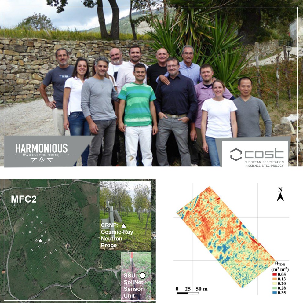 How to cite: Paruta, A., P. Nasta, G. Ciraolo, F. Capodici, S. Manfreda, N. Romano, E. Bendor, Y. Zeng, A. Maltese, S. F. Dal Sasso and R. Zhuang, A geostatistical approach to map near-surface soil moisture through hyper-spatial resolution thermal inertia, IEEE Transactions on Geoscience and Remote Sensing, (doi: 10.1109/TGRS.2020.3019200) 2020. [pdf]
Related posts


website
big black teen apparel theft.http://desivideos4k.com/ cassandra nix and eva karera threesome.