
http://antarvasnavideos.pro sex videos kinky babe fisting her large pussy. https://bigboobslovers.net/ hungry mom loves throat fucking.
1 May 2024
We would like to report an interesting community paper titled ‘Advancing river monitoring using image-based techniques: Challenges and opportunities,’ just published on #HSJ! This significant milestone […]
31 March 2024

We are promoting a special session on Advancing Environmental Monitoring with Image-Based Solutions at the IEEEMetroXRAINE in London, OCTOBER 21-23, 2024. This special session at the […]
1 February 2024

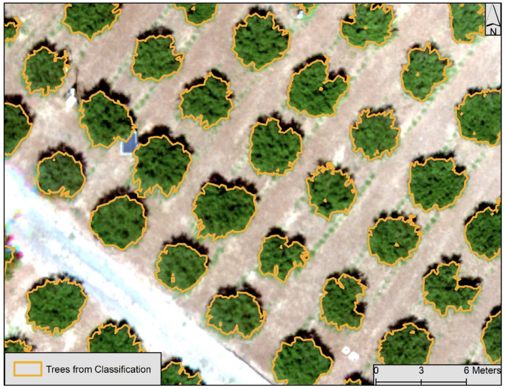
Advancements in technology have paved the way for innovative solutions in various fields, and the realm of agriculture is no exception. A recent study introduces a […]
18 November 2023
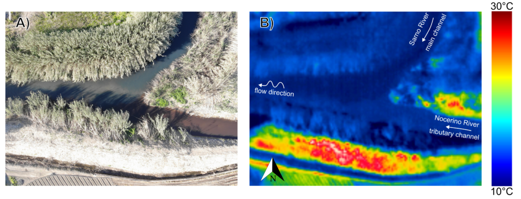
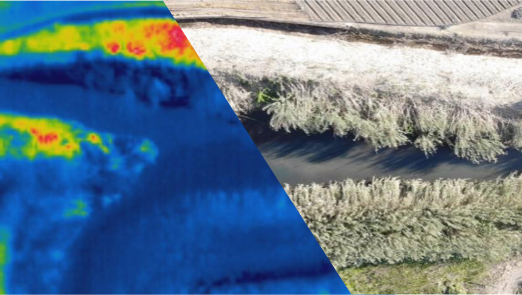
The preprint of a groundbreaking paper by #MOXXI on hydrological monitoring is now available on the EarthArXiv Preprint Service. This is the link: https://lnkd.in/d_8fzgic The work is supported by OurMED […]
21 October 2023

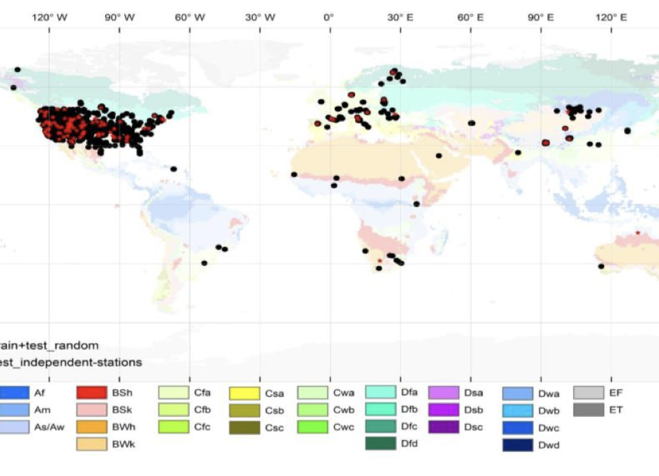
Accurate information on surface soil moisture (SSM) content at a global scale under different climatic conditions is important for hydrological and climatological applications. Machine-learning-based systematic integration […]
15 October 2023

HARMONIOUS member have recently published an interesting manuscript on “Intercomparison of Recent Microwave Satellite Soil Moisture Products on European Ecoregions” is Now Online: https://doi.org/10.1016/j.jhydrol.2023.130311 The study […]
7 October 2023
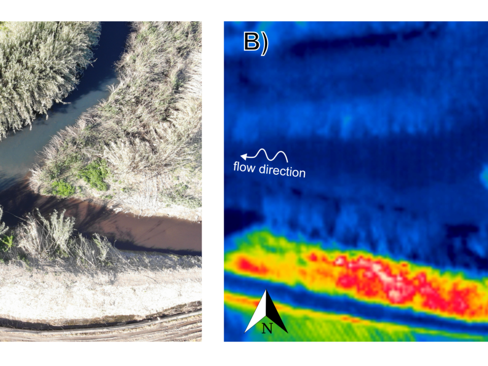
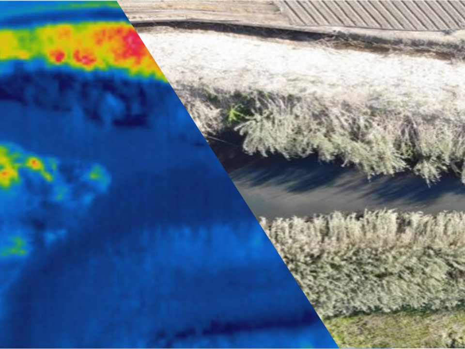
This chapter presents a general outlook of innovative monitoring of rivers. Special attention is given to river flow monitoring through remote sensing images. Because of the […]
4 September 2023

Exciting News! 🌱 Researchers from the Harmonious Group have just released their latest work: “Estimation of water-infiltration rate in Mediterranean sandy soils using airborne hyperspectral sensors.” 🌍🔬 This groundbreaking […]
8 June 2023
Abstract. Accurate information on surface soil moisture (SSM) content at a global scale under different climatic conditions is important for hydrological and climatological applications. Machine learning (ML) […]
website
big black teen apparel theft.http://desivideos4k.com/ cassandra nix and eva karera threesome.